
Village Elevation: 1365m / Summit Elevation: 2037m / Total number of lifts: 13 / Highest Lifted Point: 2037m Karel’s T-bar / Lowest Lifted Point: 1365m Friday Flat
 Forecasts by
Pete ‘The Frog’ Taylor

LIVE TEMP: -5
PREDICTED SNOWFALL
NEXT 5 DAYS: 2-5cm
NEXT 10 DAYS: 3-7cm
NEXT 15 DAYS: 3-8cm
LIVE CAMS
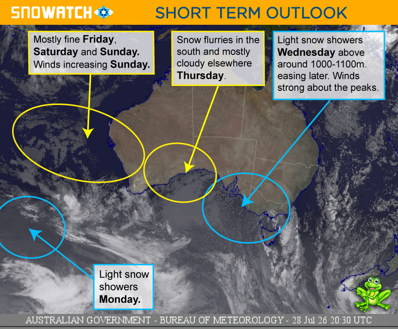
NEXT 4 DAYS
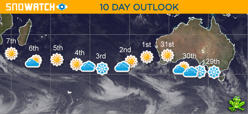
10 DAY OUTLOOK
Updated: July 29th, 6:56am (Forecast Period 6am-6am<)
WEDNESDAY 29TH

Morning
➤
Midday
➤

Night
SNOW: 2 - 5cm
Windy and cool with light snow showers above 1000m in the south and 1100m in the north. Easing later in the north.
CURR TEMP
-5
SNOWMAKING
LIKELY
WIND
WSW-SW
STRONG
➤
MODERATE

THURSDAY 30TH

Morning
➤
Midday
➤

Night
SNOW: 0cm
Partly cloudy in the north and mostly cloudy in the south with some light snow flurries at times. Clearing overnight. Winds gusty about the peaks and easing later.
SNOWMAKING
LIKELY
WIND
SSW-S
MODERATE
➤
LIGHT
FRIDAY 31ST

Morning
➤
Midday
➤
Night
SNOW: 0cm
A mostly fine and sunny day in the north with some cloudy periods during the day in the south.
SNOWMAKING
LIKELY
WIND
S-N
LIGHT

SATURDAY 1ST
Morning
➤
Midday
➤
Night
SNOW: 0cm
A mostly fine and sunny day.
SNOWMAKING
LIKELY
WIND
N-NNW
LIGHT
➤
MODERATE
SUNDAY 2ND
Morning
➤
Midday
➤

Night
SNOW: 0cm
A mostly fine day with cloud increasing later in the north. Possible snow showers above 1500m in early hours of Monday. Winds increasing.
SNOWMAKING
POSSIBLE
WIND
NNW
MODERATE
➤
STRONG
MONDAY 3RD
Morning
➤
Midday
➤
Night
SNOW: 1 - 2cm
Cool and windy with light snow showers above 1300m. Clearing overnight.
SNOWMAKING
LIKELY
WIND
NW-WSW
STRONG
TUESDAY 4TH
Morning
➤
Midday
➤
Night
SNOW: 0cm
Cloud clearing in the north. Mostly cloudy in the south.
SNOWMAKING
LIKELY
WIND
SSW-S
MODERATE
➤
LIGHT
WEDNESDAY 5TH
Morning
➤
Midday
➤
Night
SNOW: 0cm
Mostly fine with some cloudy periods in the south. Cloud increasing in the south overnight.
SNOWMAKING
LIKELY
WIND
S-S
LIGHT
THURSDAY 6TH
Morning
➤
Midday
➤
Night
SNOW: 0cm
A partly cloudy day, clearing overnight.
SNOWMAKING
LIKELY
WIND
SE
LIGHT
FRIDAY 7TH
Morning
➤
Midday
➤
Night
SNOW: 0cm
A mostly fine and sunny day.
SNOWMAKING
LIKELY
WIND
ENE-NE
LIGHT
SATURDAY 8TH
Morning
➤
Midday
➤
Night
SNOW: 0cm
A mostly fine day with cloud and winds increasing later.
SNOWMAKING
POSSIBLE
WIND
N-NNW
LIGHT
➤
MODERATE
SUNDAY 9TH
Morning
➤
Midday
➤

Night
SNOW: 0cm
Mostly fine during the day with cloud increasing later. Possible showers developing early hours of Monday. Winds increasing to strong overnight.
SNOWMAKING
UNLIKELY
WIND
NW-NNW
MODERATE
➤
STRONG
MONDAY 10TH
Morning
➤

Midday
➤
Night
SNOW: 0cm
Showers and rain developing with strong winds. Showers easing overnight with the chance of some snow falling about the peaks.
SNOWMAKING
UNLIKELY
WIND
NW-WNW
STRONG
TUESDAY 11TH
Morning
➤
Midday
➤
Night
SNOW: 0 - 1cm
Cloudy with light showers - falling as snow above 1700m.
SNOWMAKING
UNLIKELY
WIND
NW
MODERATE
WEDNESDAY 12TH
Morning
➤
Midday
➤
Night
SNOW: 0cm
Mostly cloudy with light showers developing ahead of a cool change overnight that should see snow falling in the early hours on the 13th.
SNOWMAKING
UNLIKELY
WIND
NW-NNW
STRONG